Calstock Station to The Danescombe Valley Circular Walk

Strenuous

3¾ miles (6km)

2 hours

The creation of this walking route has been led by the Tamara Landscape Partnership Scheme, a project run by the Tamar Valley National Landscape and funded by the National Lottery Heritage Fund.

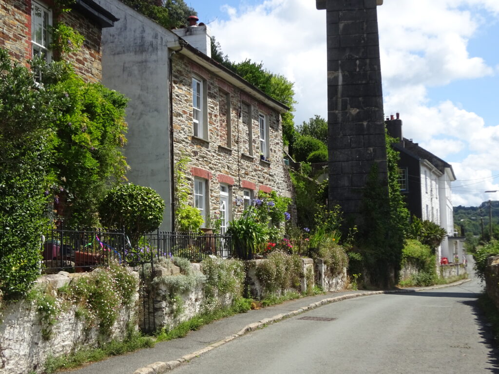
Picturesque cottage on Lower Kelly
A short yet adventurous exploration, packed with historic interest, utilising the Danescombe Valley’s intricate network of woodland paths and tracks.
SUMMARY

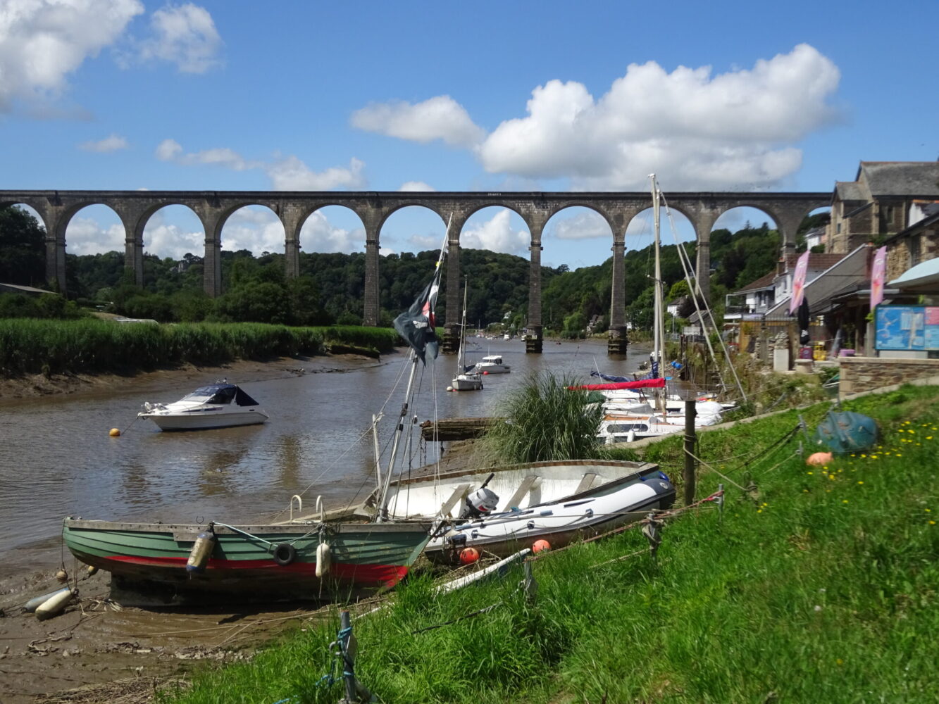
A fascinating walk which delves into Calstock’s 19th-century past, when the village was an important port. Archive photos reveal a time when industrial activity was at its height; valleys-side paths cross open ground above a line of riverside quays, where traditional Tamar sailing barges wait to unload their cargoes. This interesting figure-of-eight walk explores this complex network of (now) woodland paths and encounters the old mineral railway incline, a derelict sawmill, Wheal Calstock and Cotehele Consols, and a run of old quays along the Tamar.

KEY FACTS

Start/Finish

Calstock Station SX 434687, PL18 9RS

Distance

3¾ miles (6km)

Time

2 hours

Terrain

Woodland tracks and paths, some rough and narrow; regular ascents/descents; quiet level lane on return

Difficulty Rating

Strenuous

Toilets

None on route

Parking

Public Transport

Rail services Tamar Valley Line to/from Gunnislake and Plymouth; bus services to/from Callington, Gunnislake and Tavistock

Dogs

Under control at all times

Directions

1 SX 434687

Head down the tarmac access path, following signs to the village centre, quay and Cotehele, to reach Sand Lane; cross over and turn right, uphill, to pass under the viaduct (constructed 1904–7 to connect the railway at Bere Alston with the East Cornwall Mineral Railway, later converted for passenger use as far as Gunnislake).

2 SX 433687

After 20 yards bear left along Higher Kelly (dead end), keeping straight on at an early junction. This high-level lane affords wonderful views towards Cotehele House, peeping out of the trees high above the river, and passes spectacular houses with ingeniously terraced gardens. At the end of the lane pick up a narrow path, passing to the right of a house, and ascend steadily through woodland. The path levels above a house and garden, then ascends gently, passing a footpath (right). A bridge carries the path over the old East Cornwall Mineral Railway incline; the railway opened in 1872 to service mines between Calstock and Kelly Bray (for Callington), and was connected to the Tamar’s quays by a rope-worked counterbalance inclined plane which raised and lowered trucks up and down the steep valley side.

3 SX 426691

Immediately over the bridge turn left down steps; turn right, downhill, to cross two more bridges. Bear left to a path junction.

4 SX 426690

Turn sharp left on a rough and rocky way between high walls, passing under the last bridge, heading towards the Danescombe Valley. The path reaches a track T-junction. Turn left, downhill, passing picturesque cottages, to meet the riverside lane by Danescombe Valley House

5 SX 426689

Turn right to pass Danescombe Pottery and cottages to reach a path junction (Cotehele House left). The steep, south-facing (now wooded slopes) on the right were once home to market gardens growing fruit and flowers. Keep straight on to pass the derelict Danescombe Sawmill; follow the track on alongside the stream. Ignore a path bearing left, uphill, and continue on to reach Wheal Calstock (later, Danescombe Valley Mine), where old mine buildings have been converted into cottages. The track crosses the stream and soon passes the huge converted engine house and mine buildings of Cotehele Consols, an old copper and arsenic mine. Continue up the valley, the path now rough and rocky, ignoring any side paths. The path reaches a lane in the tucked-away hamlet of Danescombe (the remains of an old papermill are just a little further upstream).

6 SX 419697

Turn right, ascending steeply. Opposite a dead end sign bear right through a gate on a public footpath. Follow the narrow path down through woodland, passing a derelict building. Through a gap in the trees look out for the Prospect Tower on the Cotehele estate: a three-sided folly said by some to commemorate the visit of King George III and Queen Charlotte in 1789. The path passes directly in front of a house, then descends to meet a wider path.

7 SX 423694

Keep straight on through woodland; you’ll start to get glimpses of floodplain fields on the opposite side of the river. Pass a path junction (met on Point 4) and pick up the outward route, descending past cottages to the riverside lane (Point 5). Keep straight on past Danescombe Valley House, built in the 1850s and, for much of the 20th century, run as a small hotel for visitors arriving by boat at Kingfisher Quay below. Note a house signed ‘Danescombe Quay 1822’, then pass a huge limekiln and go under a bridge, which carried the inclined plane to the riverside. Another limekiln is soon passed opposite Calstock boatyard (site of Kelly Quay). Pass under the viaduct; note ‘Steamer Quay’ towards the end of Lower Kelly. Meet Commercial Road and turn left, uphill, to find the station on the right.

Map

All Short Walks

Whether you’re an avid hiker eager for a week-long adventure tracing the Tamar River from sea to source or just looking for a short stroll to a cosy pub, there’s something for everyone. 

Find out more about our marvellous landscape by visiting the Tamar Valley National Landscape’s website. 

Filter by Difficulty

Filter by Town

NEar by