Holmbush Mine Circular Walk

Easy

Just under 1½ miles (2.4km)

45 minutes

The creation of this walking route has been led by the Tamara Landscape Partnership Scheme, a project run by the Tamar Valley National Landscape and funded by the National Lottery Heritage Fund.

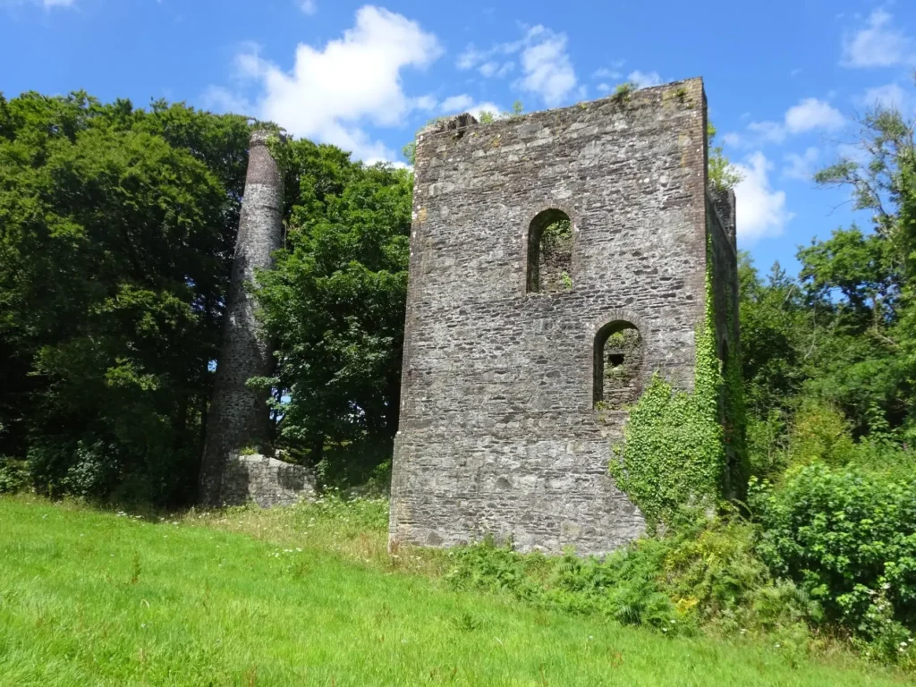
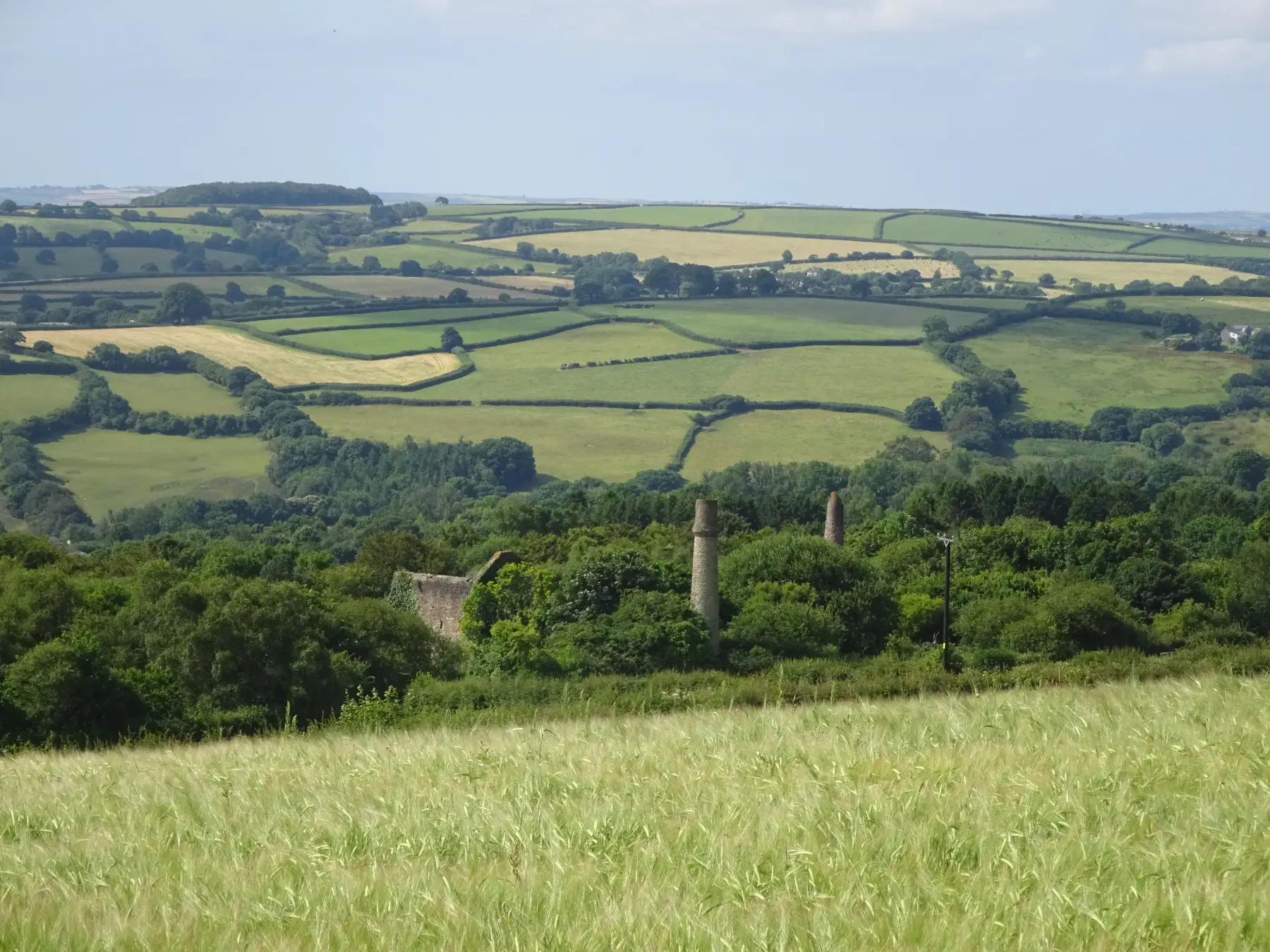
Chimney and winding engine house, Holmbush Mine: remnants of a once-flourishing industry
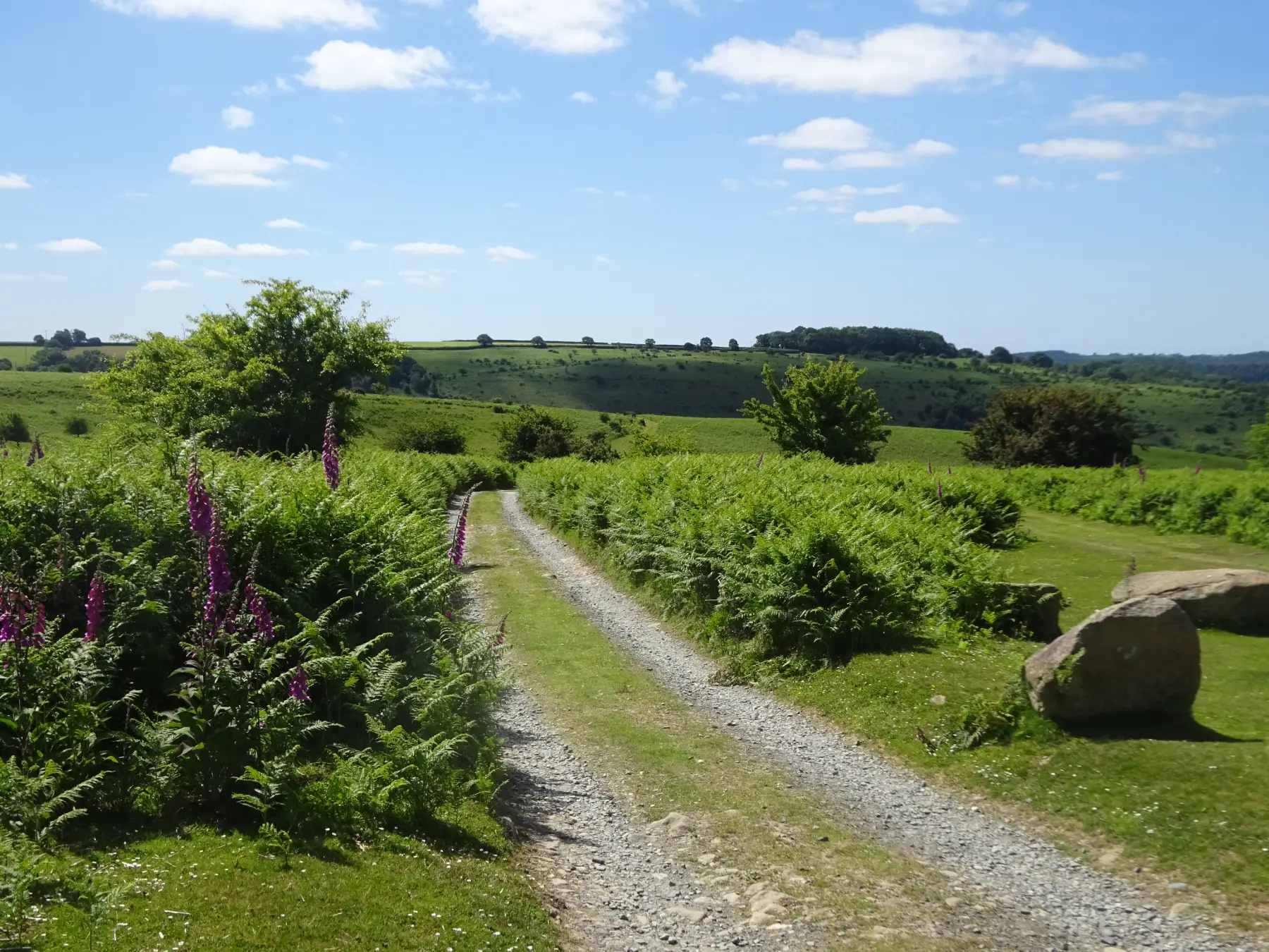
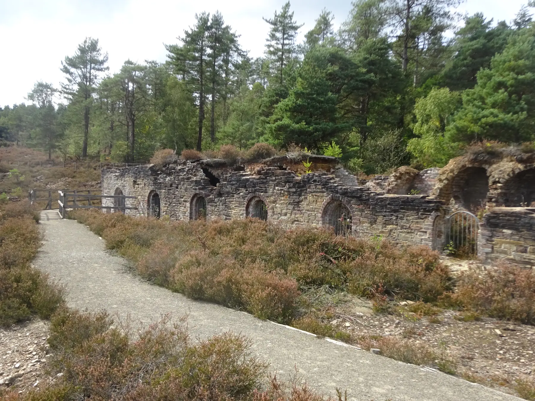
Discover a leisurely stroll along permissive paths meandering through woodlands near Kelly Bray. This delightful walk also includes a fascinating stopover at the ruins of Holmbush Mine, which held great significance as the primary mining site in the Callington district.

SUMMARY

Experience a leisurely walk through Holmbush Wood, where deciduous woodland and conifer plantations create a captivating landscape. This wood, nestled between the A388 and the Stoke Climsland road just north of Kelly Bray and is owned by the Duchy of Cornwall. You’ll encounter an intricate network of tracks, paths, and ancient field boundaries, attracting dog walkers and nature enthusiasts alike. This easy circuit takes you on a delightful journey. Along the way, you’ll have the chance to explore the awe-inspiring remnants of Holmbush Mine, once a bustling hub of productivity that employed some 300 people during its peak

KEY FACTS

Start/Finish

Holmbush Wood parking area just under ½ mile (0.8km) north of Kelly Bray, on Stoke Climsland road SX 357721, PL17 8PN

Distance

Just under 1½ miles (2.4km)

Time

45 minutes

Terrain

Easy woodland paths and tracks

Difficulty Rating

Easy

Toilets

None on route

Parking

Holmbush Wood

Public Transport

Bus services (to Kelly Bray) to/from Callington, Launceston, Plymouth, Saltash and Tavistock

Dogs

Under control at all times

Directions

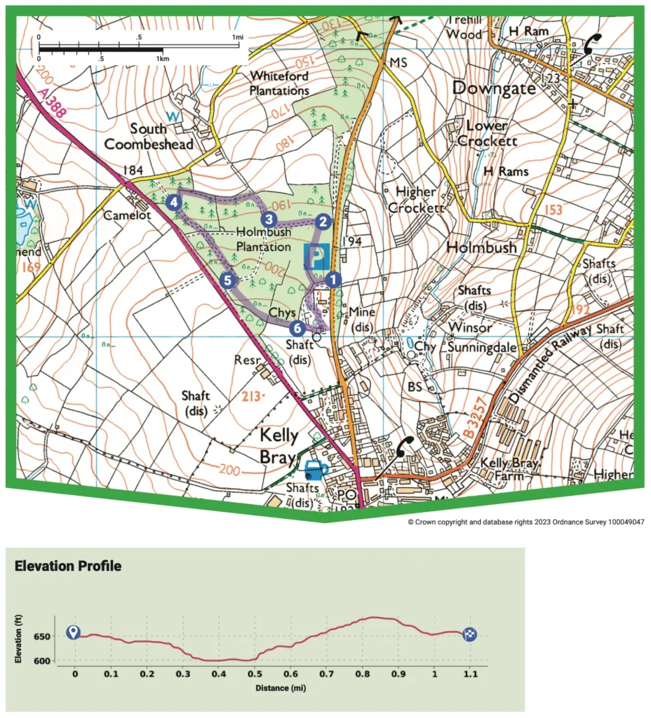
1 SX 357721

Once you leave the road, follow the path leading you towards a field gate and information board, providing fascinating insights into the history of Holmbush Mine. Pass through the gate, turning right and cross a low bank. Afterward, take a sharp right turn, crossing the next low bank, and then make a left turn. When you reach a junction of paths – bear right, choosing the broadest path available. Initially, this path will lead you through a serene stretch of mature conifers, running parallel to the Stoke Climsland road. Keep following it until you reach a T-junction.

2 SX 358724

Make a left turn, and on either side of the path, you’ll see vibrant rosebay willowherb during the summer. As you walk, you’ll also notice a delightful assortment of deciduous saplings, including birch, oak, sweet chestnut, sycamore, beech, and mountain ash, interspersed with occasional patches of conifers. Continue until you arrive at a T-junction in a clearing.

3 SX 355723

Turn right. The path will gently veer left as it takes you under a majestic canopy of tall beech trees at the northern end of the wood. Along this stretch, there’s a hedgebank that offers picturesque views across the fields towards Stoke Climsland. When you reach a fork in the path, where an old banked track continues straight ahead, bear left, following the trail that runs along the northern boundary. This part of the path is narrower and rougher. As you walk, you’ll pass by a bench, providing a pleasant spot to pause and enjoy the surroundings. Soon, you’ll approach a path junction on the edge of a stand of conifers. Continue ahead passing through a gap in an ancient field bank until you finally arrive at a T-junction.

4 SX 352724

Turn left. By this time you’ll hear traffic hurtling along the A388; keep straight on at a path crossroads, and eventually reach a T-junction.

5 SX 354722

Follow the path turning right onto a wide track. As you progress, you’ll see a gate leading to the A388; before reaching it, veer left through a glade of mature beech trees. Passing through a gap in a bank, bear slightly to the right, following alongside a hedgebank. This will lead you to the fascinating old mine buildings situated on the southern edge of the wood. Unless you’re walking during the winter season, the chimney and the ruins of the winding engine house may not come into view until you’re almost level with them. So, keep an eye out for the ruins as you continue your journey.

6 SX 357720

After crossing a bank near the chimney, continue on past the engine house. On the right, a small path winds its way into the interior of the building, accessible via a ladder. Follow a narrow path that leads you to the mining site, taking a rightward direction as it threads through the area. Along this route, you’ll encounter various remnants of mine buildings, though some may be hard to distinguish: fenced-off shafts, water wheel and crank pits, a copper crushing house, and spoil heaps. The rich history of Holmbush Mine dates back to the 17th century when lead and silver were initially mined here. As time passed, copper ore became the primary focus, continuing through much of the 19th century. The mine showcased its remarkable achievements at the Great Exhibition of 1851, where single specimens of silver lead ore and copper ore, each weighing between 1 to 1½ tons, were proudly displayed. In the late 19th century, Holmbush Mine joined other renowned Tamar Valley mines as a prolific producer of arsenic until it finally ceased operations in 1923. The mine’s output was remarkable, especially considering that this area was once known as Kilbury, a simple junction of moorland paths. Continuing on the path, you’ll pass a second chimney and come across the castle-like ruin of Hitchen’s pumping engine house, now covered in ivy. Just beyond the engine house, bear left at a junction, taking a narrow path, which may be overgrown during summer, leading you back to the lower end of the broad beech avenue that guides you towards the mine. Finally, turn right to return to the car park, concluding your exploration of Holmbush Mine and its intriguing past.
Map

All Short Walks

Whether you’re an avid hiker eager for a week-long adventure tracing the Tamar River from sea to source or just looking for a short stroll to a cosy pub, there’s something for everyone. 

Find out more about our marvellous landscape by visiting the Tamar Valley National Landscape’s website. 

Filter by Difficulty

Filter by Town

NEar by