Tavistock Canal Circular Walk

Easy

5½ miles (8.8km)

2½ hours

The creation of this walking route has been led by the Tamara Landscape Partnership Scheme, a project run by the Tamar Valley National Landscape and funded by the National Lottery Heritage Fund.

A gentle and picturesque stroll along the wooded banks of an early 19th-century canal, constructed to link Tavistock’s copper-rich mining areas to the port of Morwellham on the tidal River Tamar.
SUMMARY

The Tavistock Canal, built between 1803 and 1817 to the design of engineer John Taylor, was an extraordinary feat of construction, necessitating a tunnel through Morwell Down, a huge aqueduct across the Lumburn valley, and a waterwheel-powered inclined railway to carry cargoes down to Morwellham, 235ft (72m) below the tunnel portal. The coming of the railway to Tavistock in 1859, coupled with a slump in the price of copper in the 1860s, spelled disaster; by 1873 barge traffic had ceased. Today the canalside path offers a tranquil walking route. Look out for the ‘Poetry Trail’, an initiative led by poet James Crowden, working with students at Tavistock College in 2012, and restored in 2021.

KEY FACTS

Start/Finish

Abbey Bridge, Tavistock SX 482743, PL19 0BW

Distance

5½ miles (8.8km)

Time

2½ hours

Terrain

Level tarmac ways and canal-side path, muddy in places in winter

Difficulty Rating

Easy

Toilets

Parking

Bedford car park, Tavistock (pay & display)

Public Transport

Bus services to/from Callington, Okehampton and Plymouth

Dogs

Under control at all times

Directions

1 SX 482743

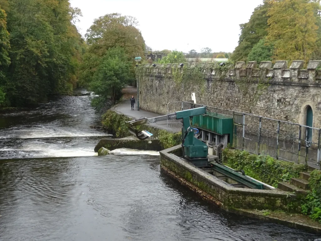
Take a look downstream from Abbey Bridge. To the right of the weir you can see the head of the canal feeder channel; a mechanical scoop keeps the sluice gates clear of leaves and other debris. When barge traffic stopped the canal was used to supply water to mines along its route until 1930. In 1933 it was bought by West Devon Electric Supply Company to feed their hydro-electric power station at Morwellham, still operating today. Head towards the roundabout, then bear right down St John’s Avenue. Pass to the right of a car park then through Benson Meadow, named after a 19th-century benefactor (look out for St John’s Holy Well on the left).

2 SX 479740

Cross the Tavy on an iron bridge to enter The Meadows, former meadowland which became a park in 1898. Turn left; pass the children’s playground and take the next path right, to leave the park and pass under Plymouth Road. Turn right up steps, then right and left to meet the canal opposite Fitzford Cottages, built to house Bedford estate miners, farm and foundry workers in 1862.

3 SX 475738

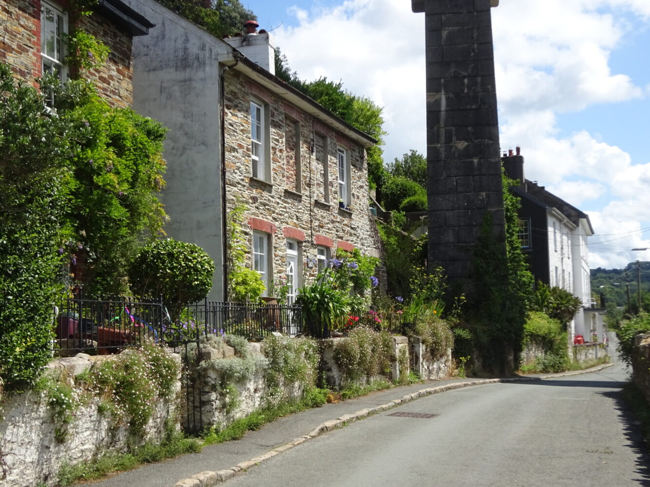
Turn left along the narrow canal-side path. Pass Monksmead Swing Bridge; the path broadens as it runs through Crowndale Woods. Quarries on the far bank provided the stone used to build the canal; if the water is low you can sometimes see where the horse-drawn barges (one horse downstream, two horses back up) scarred the stone lining. The canal runs behind Crowndale Farm; Sir Francis Drake was born in a longhouse here in 1540. Follow the path under a pretty single-arched stone bridge, built to access Wheal Crowndale, which opened in 1799 and produced copper (note blue-green staining on the underside of the bridge) and arsenic, and some tin and iron. Pass an engraved wooden post bearing MM (Millennium), T (Tavistock) and G (Gulworthy), marking the parish boundary, as the canal curves right at Shillamill; the Rivey Tavy, far below, heads south to join the River Tamar. The canal continues to bear right, now running up the valley of the River Lumburn, and carried over the old road to Bere Alston (now an overgrown track) via an iron bridge. The magnificent Shillamill Viaduct was built in 1889 by the Plymouth, Devonport & South Western Junction Railway, one of four such structures between Plymouth and Tavistock (the line closed in 1968). Walk on to reach the only lock on the canal, complete with lock-keeper’s cottage, and a dock for tying up barges. Continue over the rock-built aqueduct, towering 60ft (18m) above the River Lumburn.

4 SX 461725

Reach the end of public access along the canal, marked by a wooden installation and poem by James Crowden: ‘End Game’. Here the canal bears left into private land, soon entering a 1½-mile (2.4km) long tunnel, cut deep through Morwell Down, to emerge high above Morwellham (the waters now diverted into a reservoir to feed the HEP station). A track heading away on the far bank is an old tramway, built over a canal spur intended to serve slate quarries at Mill Hill. There was never enough water (sourced from the Lumburn) to render it usable, and it was replaced by horse-drawn wheeled transport. Retrace your steps along the canal to pass under the Plymouth road and enter The Meadows.

5 SX 476738

Take the first path left to pick up the canal again, and turn right alongside it. Pass Meadowlands Leisure Centre to reach the old canal wharf and the point where the canal emerges under the bridge on Canal Road (access to Bedford car park); an information board details the history of the canal and adjacent buildings. Continue on to the edge of the car park, then turn right to pass through the boundary wall and meet the River Tavy; turn left along the Abbey Walk. Pass the Abbey Still Tower (restored in 1884), where the monks distilled herbal medicines, using flora from their nearby gardens, on your way back to Abbey Bridge.

Map

All Short Walks

Whether you’re an avid hiker eager for a week-long adventure tracing the Tamar River from sea to source or just looking for a short stroll to a cosy pub, there’s something for everyone. 

Find out more about our marvellous landscape by visiting the Tamar Valley National Landscape’s website. 

Filter by Difficulty

Filter by Town

NEar by