Bere Ferrers Station to Bere Alston Via Lockeridge Farm Walk

Strenuous

6½ miles (10.4km)

3½ hours

The creation of this walking route has been led by the Tamara Landscape Partnership Scheme, a project run by the Tamar Valley National Landscape and funded by the National Lottery Heritage Fund.

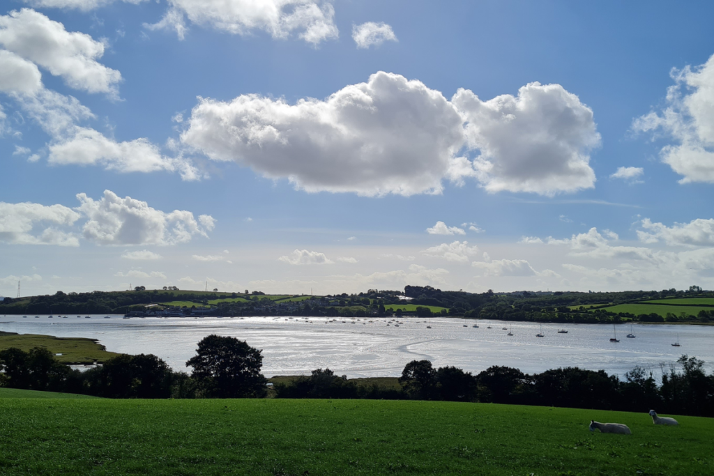
Follow the River Tamar upriver from Bere Ferrers along a stretch of the Tamara Coast to Coast Way, via sweeping pasture fields, woodland and quiet lanes: a simply beautiful walk.
SUMMARY

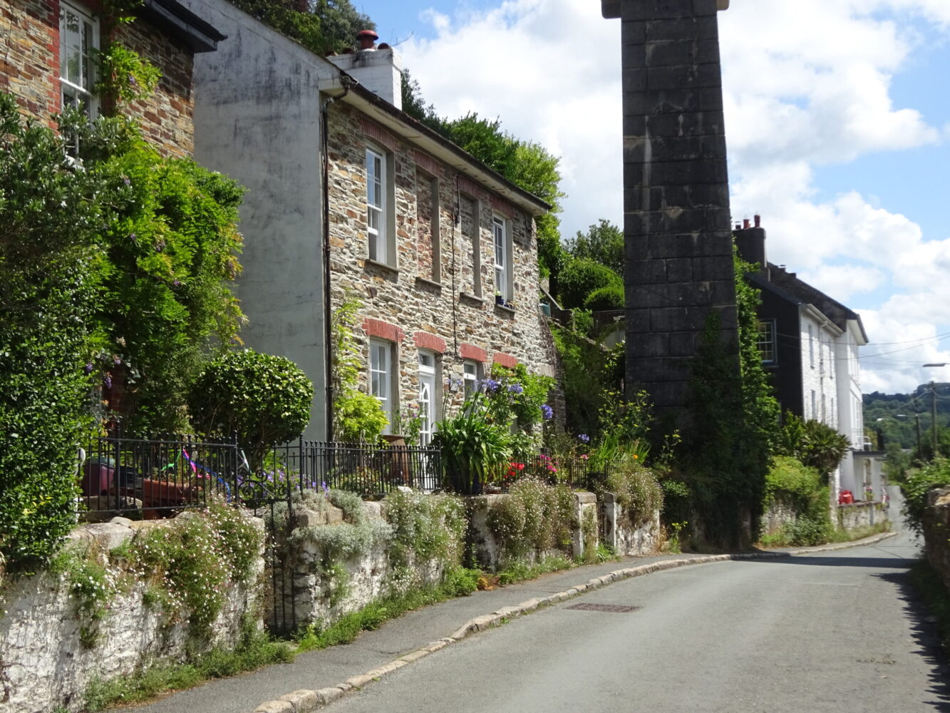
The Tamara Coast to Coast Way (TCCW) is a waymarked 87-mile walking route linking Cremyll on the south coast of Cornwall to Marsland Mouth on the north coast. The route follows the Cornwall–Devon border as closely as possible. This delightful walk, heading upriver on the west side of the peaceful Bere peninsula, encounters glorious views and some fascinating historic sites. Use the picturesque Tamar Valley Line to access the start, then hop on the train again at the end of your walk!

KEY FACTS

Start/Finish

Bere Ferrers Station SX 452635, PL20 7JR

Distance

6½ miles (10.4km)

Time

3½ hours

Terrain

Steep ascent and descent over South Hooe peninsula

Difficulty Rating

Strenuous

Toilets

None on route

Parking

Public Transport

Rail services Tamar Valley Line to/from Gunnislake and Plymouth; bus services to/from Bere Ferrers and Tavistock

Dogs

Under control at all times; non-dog-friendly stiles

Directions

1 SX 452635

From the station, on the main line between Plymouth and London Waterloo from 1890 until the 1960s (the branch line to Gunnislake was retained as the Tamar Valley Line) then head down the access road and turn right on Station Road.

2 SX 453634

Where the road bears left, turn right on a dead end lane (also Station Road), joining the TCCW. The lane deteriorates to a track by farm buildings, bearing right under the railway line. Keep ahead on a broad track, passing an old orchard. Cross a stile by the next gate and keep straight on, initially along the edge of a big pasture field often occupied by cows, and through a gate in the next hedge. Keep along the left edge of the next two fields (you may encounter more cows) cresting a hill midway. Enjoy increasingly good views downriver to the mid-20th-century Tamar Bridge, spanning the river between Plymouth and Saltash alongside Isambard Kingdom Brunel’s railway bridge, which opened in 1859. There are extensive areas of saltmarsh upriver on the Devon shore, regularly refreshed by the rising tide. The estuaries of the Tamar and its tributaries the Lynher (Cornish side) and Tavy (Devon side) host more than 30% of Devon and Cornwall’s saltmarsh. Descend towards the river; in medieval times Cargeeen, on the opposite shore, traded in cured Tamar salmon. From the 19th and into the 20th century Thorn Point was linked by ferry to Cargreen. Market garden produce was ferried across the river for onward transport to London or Plymouth by train from Bere Ferrers.

3 SX 441631

In the bottom corner note a stile in the hedge ahead, but do not cross over (a there-and-back across marshy ground to Thorn Point). Turn right, alongside beautiful oak trees which tower over the saltmarsh. At field end follow the hedge right to cross a V-stile. Cross damp ground – there’s a stretch of boardwalk – then follow the edge of a small meadow; a narrow boardwalk crosses a stream. On old maps ‘Egypt’ denotes a farm settlement nearby; the creek at Liphill is sometimes referred to as ‘Egypt Creek’ (on account of its supposed similarity to the Nile delta!). Continue along the lower edge of two more fields. At field end pass through a gate and head down a narrow path. Now silted up, Liphill Quay was built to service local lead and silver mines. Two parallel mineral lodes run north–south along the Bere peninsula; the mines, many dating back to medieval times, were some of the most prized in England, and originally owned by the king. Smuggling is also linked with this tucked-away spot. Negotiate wet ground via boardwalks; cross the slipway and turn right to reach a path junction at the bottom of a concrete track (the TCCW turns left).

4 SX 444639

Turn left through a gate along a narrow path, below an old orchard. Cross a stile and continue along the edge of two fields, linked by a stile, alongside beautiful hornbeam trees. Pass through a strip of woodland and cross a wooden bridge to meet a quiet lane.

5 SX 444644

Turn left, uphill, then descend towards the Tamar. Pass Clamoak, here entering the Cornwall and West Devon Mining Landscape World Heritage Site, then head upriver. Keep an eye out for a nice wooden installation, carved with representations of local wildlife: speckled wood butterfly, kingfisher, common sandpiper, little egret, grey heron, avocet and glow worm. On the other side of the lane a track leads to the remains of South Tamar Mine, worked for silver and lead from medieval times. With the advent of steam pumping in the 19th century, mining extended under the river; in 1856, on a Sunday (so fortunately no lives were lost) the water burst into mine, stopping profitable extraction in its tracks. Pass a limekiln on the right, then Weir Quay Boatyard, site of an 18th-century quay and, in the 19th century, the Tamar Smelting Works, servicing the South Hooe mines located on the peninsula just upriver. Pass a lane to Cotts (note the VR postbox on the corner). Across a broad meander of the river look for Pentillie Castle (on the Cornish side), built in 1698 and largely rebuilt in 1810. At Holes Hole note a house called the Basket Factory, denoting its former use; the quay here also served local mines. The house on the laneside is the former Tamar Hotel, hosting guests arriving by boat. As the lane bears right and starts to climb out of the valley look out for a footpath on the left.

6 SX 430653

Turn left on a narrow path that climbs very steeply through woodland. The gradient eventually eases; at a path junction keep straight on over a stile. Head along the right hedge; pass through a gate onto a lane, then turn left to find the next gate on the right. Head along the right edge of the next field, descending gently: there are wonderful views towards Kit Hill. Pass through a gate; look out for Cotehele Quay on the other side of the river. Continue down the right edge of the next two fields, descending very steeply towards the bottom (poles would be useful), to find steps and a kissing gate. The path crosses a boardwalk and enters a field; head uphill, pass a footpath post and leave the field via a gate. Follow a lovely embanked woodland path, dropping to pass reedbeds and reach a path junction (the TCCW turns left over a boardwalk).

7 SX 428662

Follow the path ahead, above a stream. Pass through a gate; the valley broadens and the way becomes grassy; buildings at Lockridge come into view. At a path junction turn left to cross the stream and go through a gate; turn right between farm buildings. Head up the drive then the lane, passing under the Tamar Valley Line and ascending steadily. Reach houses on the edge of Bere Alston; keep ahead to meet Station Road. Cross over and turn right.

8 SX 445688

Turn left at Drakes Park (unsigned) and head uphill. Cross Broad Park Road and continue along a narrow lane. Where the lane bears sharp right, turn left through a gate; follow a fenced footpath through another gate and downhill between horse fields (Calstock in view ahead). The path enters woodland; at a fork keep right and pick your way down to join a broad track. Keep straight on to meet a track on a bend; keep ahead again, passing houses, eventually turning sharp right to find the station.

Map

All Short Walks

Whether you’re an avid hiker eager for a week-long adventure tracing the Tamar River from sea to source or just looking for a short stroll to a cosy pub, there’s something for everyone. 

Find out more about our marvellous landscape by visiting the Tamar Valley National Landscape’s website. 

Filter by Difficulty

Filter by Town

NEar by