Bere Alston Station to Ward Mine & River Tamar Circular Walk

Moderate

3½ miles (5.6km)

2 hours

The creation of this walking route has been led by the Tamara Landscape Partnership Scheme, a project run by the Tamar Valley National Landscape and funded by the National Lottery Heritage Fund.

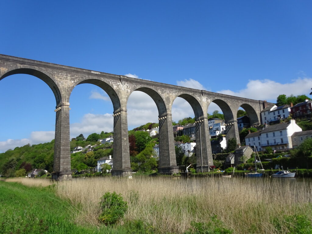
The lofty Calstock Viaduct
A lovely amble along the banks of the River Tamar, passing the picturesque and historic village of Calstock on the Cornish shore, followed by a return via quiet lanes and pastures.
SUMMARY

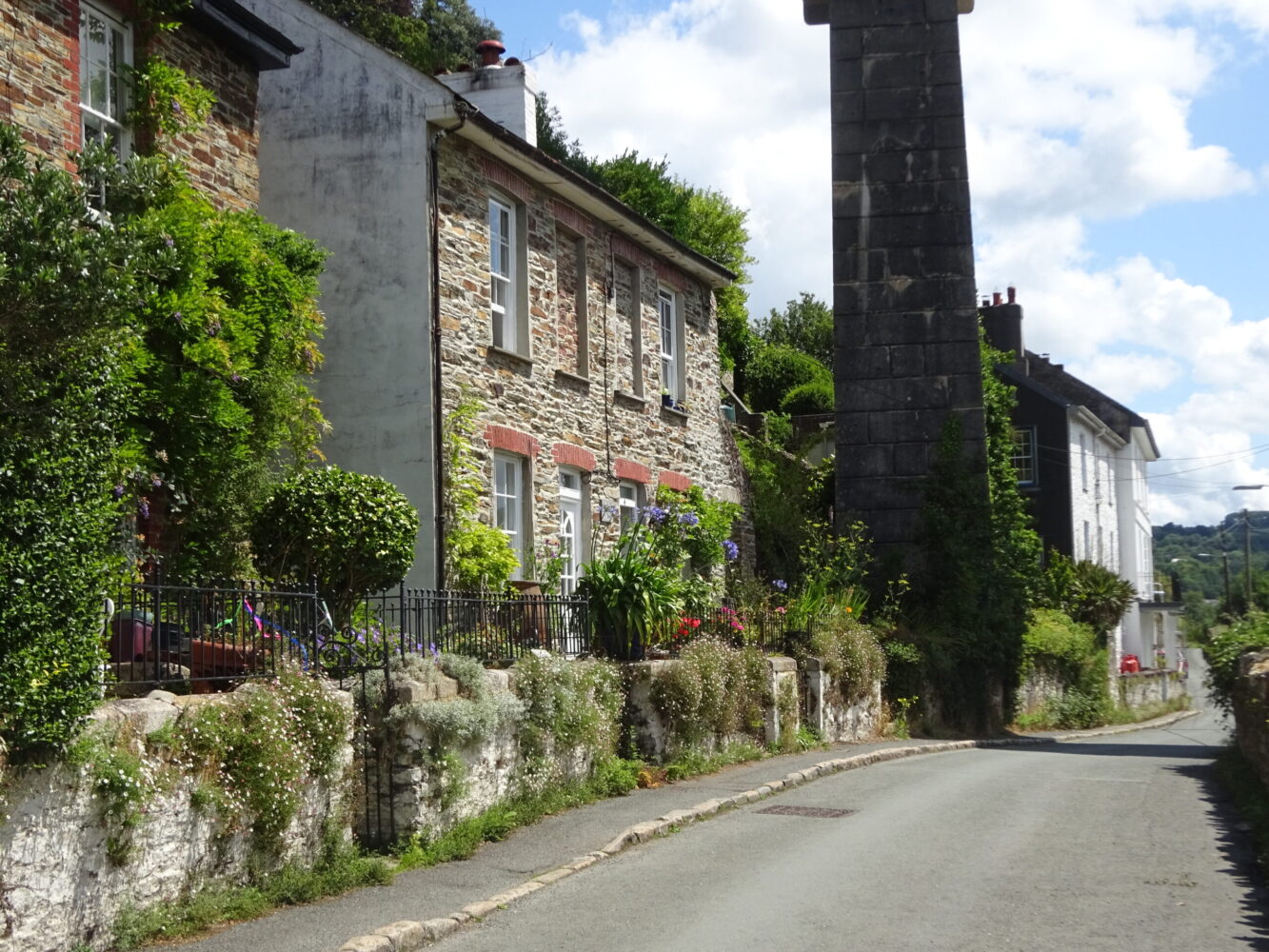
The Tamar Valley Discovery Trail (TVDT) is followed as far as Ward Mine Farm, taking in the magnificent Calstock Viaduct and the riverside embankment path before passing through fields and woodland opposite Cotehele Quay. The Tamar Valley has long been famous for its apples, cherries and flowers, especially daffodils: as you head up the lane above South Ward Farm look out for clumps of Tamar Double White daffodils in the hedgebanks (flowering in May). Discovered by Septimus Jackson of Clamoak (near Weir Quay) in 1880, these strongly scented, long-lasting flowers were sent by train to Plymouth and London markets.

KEY FACTS

Start/Finish

Bere Alston Station SX 440674, PL20 7ES

Distance

3½ miles (5.6km)

Time

2 hours

Terrain

Woodland, field and embankment-top paths; steady descent to/ascent from the River Tamar

Difficulty Rating

Moderate

Toilets

None on route

Parking

Public Transport

Rail services Tamar Valley Line to/from Gunnislake and Plymouth; bus services to/from Bere Ferrers and Tavistock

Dogs

Under control at all times; on leads in fields near Bere Alston Station

Directions

1 SX 440674

Bere Alston Station opened in 1890, and was important for the onward transport of local market garden produce in the early 20th century. Where the access drive meets the lane, turn right to pass under two railway bridges (the line to Plymouth, and then to Gunnislake). Pass a house, then turn left through a kissing gate into a field. Bear half-right, downhill: Kit Hill can be seen in the distance ahead. Cross a stream and pass a footpath post to find a kissing gate onto a narrow woodland path. Fenced-off shafts below the path are a reminder of the peninsula’s industrial past, when it was extensively mined for silver and lead; two parallel mineral lodes run north–south along its length. The mines – many dating back to medieval times – were some of the most prized in England, and originally owned by the king. Pass a path junction and keep ahead to pass below Buttspill; descend steeply through beautiful beech woodland to reach a footpath post.

2 SX 435683

Turn right for about 50 yards to reach another footpath junction and bear left, downhill, to descend steps and pick up the riverside embankment, built in the 19th century to create agricultural land. Ahead is the impressive Calstock Viaduct, constructed 1904–7 to connect the railway at Bere Alston with the East Cornwall Mineral Railway (now the Tamar Valley Line as far as Gunnislake); on the opposite bank sits the delightful Cornish village of Calstock.

3 SX 434685

Reach a path junction near Ferry Farm, which functioned as the Passage Inn during the 19th century. Keep straight on, following a permissive path along the embankment, to pass under the viaduct; ahead you may catch a glimpse of Cotehele House, redeveloped between 1485 and c. 1565, in woodland on the Cornish side of the river. Danescombe Valley House, built in the 1850s, stands on the opposite bank at a big river bend. For much of the 20th century it was run as a small hotel for visitors arriving by boat at Kingfisher Quay. The river sweeps south beyond the Danescombe valley, alongside reedbeds. Cotehele Quay comes into view on the west bank; the 19th-century embankment upriver from the quay has been deliberately breached to allow for the development of intertidal meadows, to create wildlife habitat and alleviate flooding.

4 SX 426685

At the end of the embankment cross a stile and turn right, soon passing a ruined building. Pass through a gate (a footpath comes in sharp left) and head along the edge of a big pasture field. At field end the footpath continues through beech woodland, opposite Cotehele Quay, with its range of 18th- and 19th-century buildings. Pass a slipway opposite the quay; at a footpath post bear left, uphill. Go through a gate and pass picnic tables at Ward Mine (there’s no visible evidence of the mine, which produced silver and lead in the 13th and – briefly – 19th centuries); go through another gate, then pass directly in front of Ward Mine Farm to meet a track junction (the TVDT bears right towards South Ward Farm).

5 SX 426677

Keep straight on up an ascending rough tarmac track; pause to look back across the valley and downstream along the river. Areas of riverside land on the Cornish side, enclosed in the 19th century, are now being allowed to flood, as at Cotehele. The views are stunning! An apple orchard is passed on the approach to Helston Farm; ascend between farm buildings and follow the drive up to meet a lane.

6 SX 433675

Turn right between hedgebanks thick with wild flowers in springtime. The lane ascends, then descends.

7 SX 433673

Just before the lane starts to ascend again turn left through a metal gate (footpath sign on a telegraph post on the right of the lane). Follow the field-edge path ahead to pass under the railway line (Gunnislake line) and through a gate into a field, to find a path junction. Keep straight on across the field, aiming for a couple of houses – the telecommunications mast on North Hessary Tor at Princetown on Dartmoor can be seen in the far distance – and pass through a kissing gate on the far side (re-joining the TVDT) onto a track. Turn right; pass under two railway bridges (the line to Gunnislake, and then Plymouth), then turn left to find the station.

Map

All Short Walks

Whether you’re an avid hiker eager for a week-long adventure tracing the Tamar River from sea to source or just looking for a short stroll to a cosy pub, there’s something for everyone. 

Find out more about our marvellous landscape by visiting the Tamar Valley National Landscape’s website. 

Filter by Difficulty

Filter by Town

NEar by