Calstock Station to Okel Tor Mine & the River Tamar Circular Walk

Moderate

2½ miles (4km

1½ hours

The creation of this walking route has been led by the Tamara Landscape Partnership Scheme, a project run by the Tamar Valley National Landscape and funded by the National Lottery Heritage Fund.

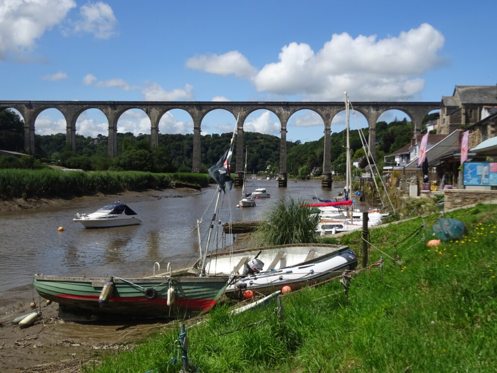
Calstock Viaduct from the quay
Follow the Tamar Valley Discovery Trail upstream past intertidal marshes to the remains of Okel Tor Mine, with a visit to Calstock parish church on the homeward leg.
SUMMARY

A walk of two distinct halves! From the picturesque village of Calstock the route follows the riverside embankment, constructed in the 19th century to reclaim the floodplain for farmland. The embankment – as in several other places along the Tamar – has been deliberately breached to allow for the development of intertidal meadows, to create wildlife habitat and alleviate flooding. The next stage ascends through woodland, with an option to visit the remains of Okel Tor Mine, closed in 1887. Calstock’s hilltop church of St Andrew is passed on the return to the station.

KEY FACTS

Start/Finish

Calstock Station SX 434687, PL18 9RS

Distance

2½ miles (4km

Time

1½ hours

Terrain

Level embankment path and woodland track; steady ascent/descent in second half of route

Difficulty Rating

Moderate

Toilets

Calstock Quay and St Andrew’s Church

Parking

Public Transport

Rail services Tamar Valley Line to/from Gunnislake and Plymouth; bus services to/from Callington, Gunnislake and Tavistock

Dogs

Under control at all times, especially on embankment path

Directions

1 SX 434687

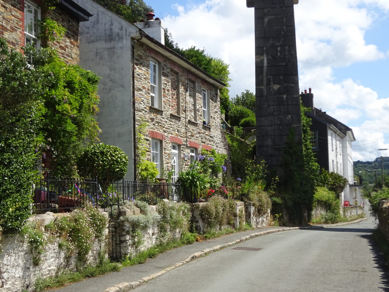
Head down the tarmac access path, following the Tamar Valley Discovery Trail (TVDT) and signs to the village centre and quay to reach Sand Lane; cross over and head downhill – you’ll get glimpses of the river and viaduct (constructed 1904–7 to connect the railway at Bere Alston with the East Cornwall Mineral Railway, later converted for passenger use as far as Gunnislake) between houses. Pass the old Methodist chapel, dating from 1910 and now home to Calstock Arts. Cross Lower Kelly and continue downhill (now on Commercial Road) to pass the Limekiln Gallery. Reach a lane junction, with the Tamar Inn ahead.

2 SX 435686

Turn right towards the river. Bear left to pass the bus stop and cross a slipway, then pick up the riverside embankment-top path, passing the picnic area, car park and recreation ground. Pass through a gate and continue along the embankment on a permissive path alongside recently created intertidal marshes. An old chimney at Rumleigh Brickworks can be seen on the opposite side of the river below the tree-covered slopes of Maddacleave Wood. Cross the bridge over the breach; cottages on the opposite bank mark the site of Tuckermarsh Quay. The embankment sweeps north and Calstock and the viaduct is lost from view: a chimney at Okel Tor Mine can be seen ahead among the trees. In summer the path is edged with clumps of meadowsweet, purple loosestrife and tufted vetch.

3 SX 444686

Pass through a kissing gate to reach a lane on a bend by the old Okel Tor Quay, with its impressive range of limekilns. Follow the rough track uphill into woodland to reach a path junction. A broad permissive there-and-back path leads right to Okel Tor Mine, where mining for silver and lead was first recorded in the 1840s. Continue uphill on the main track to pass above a chimney and mine buildings; a steady climb gains a lane and track junction. Turn left to reach a level crossing over the Tamar Valley Line.

4 SX 440689

Turn right over the crossing and head uphill. After a short sharp pull the lane bears left, passing the drive to Ferry Farm (in the 19th century a ferry crossed the Tamar here to the important port of Morwellham on the Devon side) and Harewood House. The lane runs along the top of Hare Wood – the railway is just below, hidden by trees – under lofty beech trees. Once out into the open views across the Tamar valley open up – look out for a glimpse of the impressive river cliffs on the Devon side south of Gunnislake’s New Bridge and, nearer to hand, Morwellham Quay below the steep slopes of Morwell Wood. Reach a lane on a bend by the lychgate at St Andrew’s Church, mainly dating from the 15th century. In 2007 it was discovered that the church is on the site of a Roman fort dating to AD50/55, thought to have been associated with a Roman silver mine.

5 SX 436692

Turn left to descend steep Church Hill (the TVDT goes straight on). Pass under the railway bridge, and then Rowse Gardens.

6 SX 436687

About 20 yards later turn right on a footpath (Station Lane) signed to the station. Follow it alongside a high garden wall to reach steps down onto the station platform.

Map

All Short Walks

Whether you’re an avid hiker eager for a week-long adventure tracing the Tamar River from sea to source or just looking for a short stroll to a cosy pub, there’s something for everyone. 

Find out more about our marvellous landscape by visiting the Tamar Valley National Landscape’s website. 

Filter by Difficulty

Filter by Town

NEar by